
A tornado destroyed homes and toppled trees and power lines when it roared through a small northeast Oklahoma city, one of several twisters that erupted in the central United States amid a series of powerful storms.
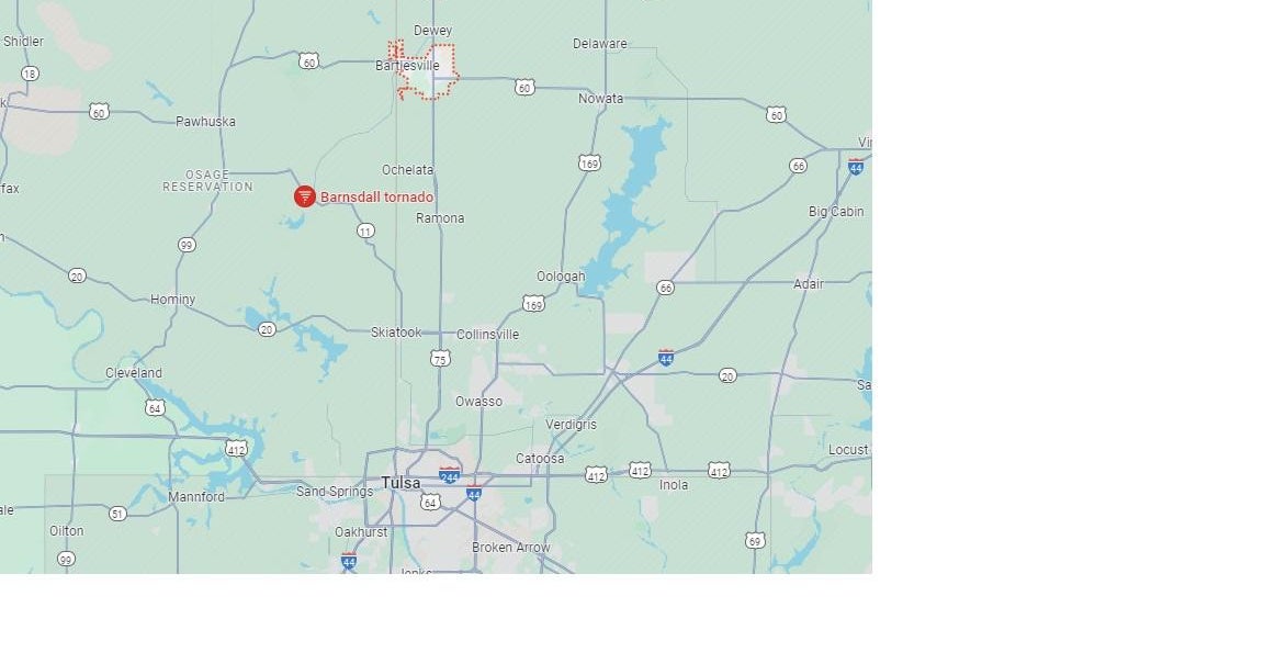
The tornado ripped through the 1,000-person city of Barnsdall, about a 40-minute drive north of Tulsa, Monday night. The nearby city of Bartlesville also took a “direct hit” from a funnel, according to Washington County Emergency Director Kary Cox.
Stephen Nehrenz, a meteorologist at CBS Tulsa affiliate KOTV, said on social media late Monday that, “The Hampton Inn in Bartlesville took a hit from tonight’s tornado. Reports are they lost most of the building’s roof. So far it sounds like most everyone there is okay from what we’ve heard initially.”
Law enforcement officers and residents surveyed the damage in one Barnsdall neighborhood as lightning flashed and heavy rain came down, local TV news footage showed. The tornado had ripped off the roof one house before spitting it back out onto the street. Osage County Sheriff Eddie Virden told KOTV there were no confirmed fatalities as of 11 p.m. local time.
The station said cited Osage County Emergency Management as saying there were confirmed reports of numerous injuries and widespread damage. OCEM said many people were believed to be trapped in their homes and that downed power lines and concern about possible gas leaks were making it difficult to respond. County officials are working to clear the roads.
Search and rescue efforts were underway at Osage Nation Reservation, authorities said.
Some 28,000 homes and businesses were in the dark in Oklahoma as of 3:30 a.m. local time.
The National Weather Service in Tulsa had warned earlier in the evening that “a large and life-threatening tornado” was headed toward Barnsdall, with wind gusts up to 70 mph. Meteorologist Brad McGavock said information on the tornado’s size and how far it traveled wasn’t immediately available Monday night.
The storms began earlier Monday with gusty winds and rain. But after dark, tornadoes were spotted skirting northern Oklahoma. At one point in the evening, a storm in the small town of Covington had “produced tornadoes off and on for over an hour,” the National Weather Service said. Throughout the area, wind farm turbines spun rapidly in the wind and blinding rain.
In Kansas, some areas were pelted by apple-sized hail 3 inches in diameter.
The storms tore through Oklahoma as areas including Sulphur and Holdenville were still recovering from a tornado that killed four and left thousands without power late last month. Both the Plains and Midwest have been hammered by tornadoes this spring.
Oklahoma’s State Emergency Operations Center, which coordinates storm response from a bunker near the state capital of Oklahoma City, was still activated from last weekend’s deadly storms.
The weather service said more than 3.4 million people, 1,614 schools and 159 hospitals in Oklahoma, portions of southern Kansas and far northern Texas, faced the most severe threat of tornadoes Monday.
Monte Tucker, a farmer and rancher in the western Oklahoma town of Sweetwater, had spent Monday putting some of his tractors and heavy equipment in barns to protect them from hail. He said he let his neighbors know they could come to his house if the weather got dangerous.
“We built a house 10 years ago, and my stubborn wife put her foot down and made sure we built a safe room,” Tucker said. He said the entire ground-level room is built with reinforced concrete walls.
Oklahoma and Kansas were under a high-risk weather warning on Monday.
Bill Bunting, deputy director of the Storm Prediction Center, said such a warning from the center is not something seen every day or every spring.
“It’s the highest level of threat we can assign,” he said.
The last time it was issued was March 31, 2023, when a massive storm system tore through parts of the South and Midwest including Arkansas, Illinois and rural Indiana.
The increased risk is due to an unusual confluence: Winds gusting up to around 75 mph were blasting through Colorado’s populated Front Range region, including the Denver area, on Monday.
The winds were being created by a low pressure system north of Colorado that was also pulling up moisture from the Gulf of Mexico, fueling the risk of severe weather on the Plains, according to the National Weather Service’s Denver-area office.
Colorado wasnlt at risk of tornadoes or thunderstorms.
The entire week is looking stormy across the U.S. The eastern U.S. and the South are expected to get the brunt of the bad weather through the rest of the week, including Indianapolis, Memphis, Nashville, St. Louis and Cincinnati, cities where more than 21 million people live. It should be clear over the weekend.
Meanwhile, floodwaters in the Houston area began receding Monday after days of heavy rain in southeastern Texas left neighborhoods flooded and led to hundreds of high-water rescues.